What is Hydrology? Meaning, Scope and Study (all explained)

What is Hydrology? Meaning, Scope and Study (all explained)

What is Hydrology? – Meaning, Scope and Study 

Compiled by Stanley Udegbunam || Nov 25, 2020

AFRILCATE 

WHAT IS HYDROLOGY?

Hydrology is the study of water on and beneath the earth’s surface, with regards to its occurrence, distribution, movement and properties as well as its relationship with the environment within each phase of the water cycle.

This science has many important applications such as flood control, irrigation, domestic and industrial water supply, and the generation of hydroelectric power.

Another similar term is hydrogeology, but don’t get confused between the two terms.

One major difference between hydrology and hydrogeology is that:

While Hydrogeology focuses only on the water flow and distribution below the earth’s surface, hydrology studies water occurrence and movement on and beneath the earth’s surface.

In other words, hydrogeology is that aspect of hydrolysis that is focused on groundwater.

While hydrology is the aspect of hydrolysis that studies both groundwater and surface water.

Since hydrology entails both surface and groundwater, it has a wider scope of study and more hydrological branches.

In the next sub-heading, we’ll look at the various scopes of hydrology with individual explanations.

Let’s continue…

SCOPE OF HYDROLOGY

They are different aspects of hydrology. They include:

  1. Study of water on and beneath the earth’s surface.
  2. Study of water occurrence, distribution and movement.
  3. Inspection of water properties.
  4. Analyzing the interaction between water and the environment at different cycle phases.

1. Study of water on and beneath the earth surface

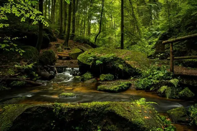
Water is central to most natural processes. It transports sediment and solutes to lakes and oceans, thereby shaping the landscape.

Hydrologic science has an important place in the field of water resources, especially freshwater resources, which are the subject of intense concern and study.

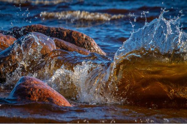
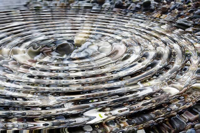
Water exists on the earth’s surface as surface water.

This includes both the saltwater in the ocean and the freshwater in rivers, streams, and lakes.

Surface water is an important source of drinking water and is used for the irrigation of farmland.

Water exists below the earth’s surface as groundwater.

Groundwater is the water present beneath Earth’s surface in soil pore spaces, underground bedrocks and in the fractures of rock formations.

Groundwater moves slowly through underground rock layers called aquifers and accounts for approximately 30% of fresh water on earth.

Surface water and groundwater are reservoirs that can feed into each other.

Surface water can seep underground to become groundwater, groundwater can also resurface on land to replenish surface water.

Want more information? Afrilcate have prepared a comprehensive study guide on both surface water and groundwater. See them here:


hydrologist scope

2. Study of water occurrence, distribution and movement

Water circulates throughout the Earth through different pathways and at different rates.

Hydrology is concerned with the continuous circulation of water in the air-atmosphere system, the hydrologic cycle.

The hydrologic cycle describes how water evaporates from the surface of the earth, rises to the atmosphere, cools and condenses into rain or snow in clouds, and falls again to the surface as precipitation.

Water takes on various forms in the environment in response to changes in temperature and other influences.

It also exists in various quantities and quality as it moves through the cycle.

Water content trapped by trees and plants also returns back to the atmosphere through transpiration or in a more general phase called evapotranspiration.

Parts of hydrology involves developing methods for directly measuring these flows or amounts of water available as well as modelling these processes either for scientific knowledge or for making a prediction in practical applications.

hydrological cycle

3. Inspection of water properties

Hydrology also deals with the physical and chemical properties of water in all its phases.

Different phase exhibits different water properties and this affects water usage.

As a result of thermal content, the kinetic energy of water varies in different states resulting in varying water properties.

The temperature, turbidity, pH levels, taste, and many more properties are key factors of a hydrologic datasheet.

4. Analyzing the interaction between water and the environment at different cycle phases

Apart from studying the natural distribution and movement of water, hydrology is also concerned with the impact of human activities on water quality as well as water management problems.

A change in water quality or quantity can affect the local environment positively or otherwise.

These changes can be:

  • man-made (e.g. a dam release)
  • weather-related (flooding), or
  • a combination of both factors (i.e. rainfall-runoff caused by poor agricultural practices).

Regardless of the cause, hydrologic data assists in explaining water quality and environmental changes.

hydrologic modelling

Precipitate reacts differently to the environment. Ocean water absorbs more radiant energy because of its low albedo, unlike ice and snow.

Water is utilized for different purposes. In homes, It’s used for drinking, cooking, cleaning, and bathing.

Water in many dams is used to produce hydroelectric power.

STUDY OF HYDROLOGY

“The person who studies hydrology is called a hydrologist”.

A hydrologist is a scientist who researches the distribution, circulation, and physical properties of the earth’s underground and surface waters.

The hydrologist plays a vital role in finding solutions to water problems and is responsible for the various aspects of hydrology described above.

They also provide answers to many hydrologic questions involving the transport of solutes, nutrients, sediment, as well as the fluxes of water itself.

hydrologist workflow

Hydrologist work flow

The main goal of the hydrologist is to increase human access to quality water so that it can be used in all ways beneficial to man as well as providing data required for the proper maintenance of water resources.

DO YOU KNOW?

In areas where groundwater is utilized faster than its natural replenishing rate,

man-made recharge method becomes a necessary option for balancing the water levels.

This human-controlled means of increasing the amount of water that enters an aquifer is called artificial recharge.

DO YOU KNOW?

In areas where groundwater is utilized faster than its natural replenishing rate, man-made recharge method becomes a necessary option for balancing the water levels.

This human-controlled means of increasing the amount of water that enters an aquifer is called artificial recharge.

What is Hydrogeology? Meaning, Study and Professional Roles

What is Hydrogeology? Meaning, Study and Professional Roles

What is Hydrogeology? – Meaning, Study and Professional Roles

Compiled by Stanley Udegbunam || Nov 24, 2020

AFRILCATE 

WHAT IS HYDROGEOLOGY?

Hydrogeology is the study of the distribution, flow, and quality of underground water.

It is an aspect of geology and it’s also called groundwater-hydrology or geohydrology.

Hydrogeology maps and quantifies the water stored in underground aquifers and occasionally surface systems.

Another similar term is hydrology, but don’t get confused between the two terms.


One major difference between hydrogeology and hydrology is that:

While hydrology studies water occurrence and movement on and beneath the earth’s surface within each phase of the water cycle, Hydrogeology focuses only on the water flow and distribution below the earth’s surface.

In other words, hydrology is the aspect of hydrolysis that studies both surface water and groundwater.

While hydrogeology is that aspect of hydrolysis that is focused on groundwater.

Clear right?

Let’s continue…

HYDROGEOLOGY STUDY

A practitioner of hydrogeology is called a hydrogeologist.

Hydrogeologists are involved in attempting to solve some of the big questions facing the world today, including sustainable water supply, environmental protection; and coping with climate change.

They work closely with a wide range of people, from individual farmers and well owners; policymakers, regulators, and planners.

They also liaise with other hydrogeologists, hydrologists, ecologists, engineers, and other professionals in related fields.

hydrogeology roles

RESPONSIBILITIES OF HYDROGEOLOGISTS

The responsibility of hydrogeologists includes:

  1. Design and construction of water wells.
  2. Testing water quality
  3. Combat groundwater pollution
  4. Harnessing Geothermal Energy
  5. Analyzing data and information relating to geological formations

1. Design and construction of water wells:

Hydrogeologists are involved in designing wells for drinking water supply, irrigation schemes, and other purposes.

They also determine the diameter, depth, and pump size required to meet the design requirement of wells.

2. Testing Water Quality:

Hydrogeologists regularly investigate water to ensure that it’s fit for its intended use.

They make sure that water is free from excessively dissolved minerals.

They are also tasked with the responsibility of de-contaminating water wells.

3. Combat Groundwater Pollution:

When the groundwater is polluted, hydrogeologists brainstorm and design effective schemes to clean up, eradicate, or drastically reduce the pollutants.

4. Harnessing Geothermal Energy:

By installing groundwater-based heat pumps, hydrogeologists tap into geothermal energy which is utilized for commercial purposes.

5. Analyzing Data and Information relating to Geological Formations:

Hydrogeologists use geographical data, environment impact assessment, and varying temperature gradients to model groundwater flow.

This enables them to predict areas of groundwater shortage due to excessive well drills or irrigations.

Evaluated data enable them to predict the impact of activities like landfills, constructions, mining and agriculture on groundwater quality and resource availability.

In a nutshell, A hydrogeologist is one who identifies pathways of flow and water recharge, assesses the chemical composition and quality of groundwater and profers solutions to negative findings.


DO YOU KNOW?

There are 4 different underground units that contribute to the formation of groundwater.

They are: Aquifers, Aquitard, Aquiclude, and Aquifuge.

DO YOU KNOW?

There are 4 different underground units that contribute to the formation of groundwater. They are:

Aquifers, Aquitard, Aquiclude, and Aquifuge.

What is Groundwater? – The Best Introductory Guide (explained)

What is Groundwater? – The Best Introductory Guide (explained)

What is Groundwater? – An Introductory Guide

Compiled by Stanley Udegbunam || Nov 23, 2020

On a first guess, one would think that groundwater is any water obtained from the ground right?

But there’s actually more to it than just the surface meaning.

This guide gives you a better explanation, an insight into how groundwater is formed and also highlights it’s basic importance.

Let’s get started…

AFRILCATE

WHAT IS GROUNDWATER?

Groundwater is water present beneath Earth’s surface in soil pore spaces, underground bedrocks and in the fractures of rock formations.


Groundwater is the largest source of freshwater for mankind and approximately 30% of the freshwater on Earth is groundwater.

Groundwater is a part of the natural water cycle and its highly susceptible to pollution.

It is stored in underground rock layers called aquifers and moves slowly through the different rock layers.

An aquifer is a body of porous rock, sediments or unconsolidated materials (gravel, sand, or silt) saturated with groundwater.

Water moves through these materials because they have large connected spaces that make them permeable.

They are called water-bearing rocks and they easily transmit water to wells and springs.

Groundwater is fed by precipitation and can resurface to replenish streams, rivers, and lakes.

Groundwater is used as drinking water by more than 50 percent of the people in the United States.

It’s also largely utilized by people who lives in rural areas.

Nevertheless, the largest use for groundwater is to irrigate crops.

Groundwater definition

HOW IS GROUNDWATER FORMED?

Groundwater forms when rain water infiltrates the soil through precipitation and percolates downwards until it reaches the water table. 

This process is called recharge.

The water is able to move underground through the rock and soil due to connected pore spaces. 

Some types of soils allow more water to infiltrate than others depending on the soil’s characteristics.

During recharge, water is pulled downward into the earth by gravity through two zones.

The upper zone, called the zone of aeration, is where a mixture of water and air fills the pore spaces.

Below the zone of aeration is the zone of saturation, where the pore spaces are completely filled by water.

The upper boundary of the zone of saturation is known as the water table.

groundwater process

Aquifers are found in the area saturated with water.

They are the underground layers of rock that holds the groundwater.

There are two types of aquifer:

  • Unconfined aquifer
  • Confined aquifer

An unconfined aquifer has a layer of permeable clay or bedrock above it therefore it’s connected to the surface through pore spaces while a confined aquifer has impermeable bedrock above.

Confined aquifers are only accessed using a well or where the aquifer meets the surface.

The amount of time that groundwater remains in aquifers is called its residence time.

This can vary widely from few days or week to thousands of years.

Confined aquifers are only accessed using a well or where the aquifer meets the surface.

The amount of time that groundwater remains in aquifers is called its residence time.

This can vary widely from few days or week to thousands of years.

Nevertheless, both aquifer type sits on an impermeable bedrock layer.

Unconfined aquifers can recharge nearby streams, during times of drought.

Rainwater can take years or even decades to reach the water table.

While rivers can flow at the rate of several kilometers per hour, groundwater can move as slowly as a meter per year.

This means it can take several thousands of years for underground aquifers to become replenished.

groundwater recharge

Groundwater is recharged by precipitation, snowmelt, or water seepage from other sources.

Groundwater is also recharged through farmland irrigation and leaks from water supply systems.

Natural outflows of groundwater take place through springs and riverbeds when the groundwater pressure is higher than atmospheric pressure in the vicinity of the ground surface.

In areas where groundwater is utilized faster than its natural replenishing rate, man-made recharge method becomes a necessary option for balancing the water levels.

This man-made recharge means is called artificial groundwater recharge.

We’ve recently published a guide on this man-made approach to tackling water shortage in aquifers.

See it here: Artificial Groundwater Recharge

The major threat to groundwater is pollution by fertilizers, pesticides, and waste from septic tanks, all of which can seep down into aquifers from the soil surface.

Groundwater definition

IMPORTANCE OF GROUNDWATER

 Out listed below are the various importance of groundwater.

  • It is the main source of water for irrigation and the food industry.
  • In some rural areas, groundwater accounts for 100% of their drinking water.
  • Globally, irrigation accounts for more than 70% of total water withdraw (both surface and groundwater).
  • Approximately 500,000 new residential wells are constructed annually, according to NGWA.
  • For the environment, groundwater plays a very important role in keeping the water level and flow into rivers, lakes and wetlands.
  • Groundwater also plays a very relevant role in sustain navigation through inland waters in the drier seasons.
  • By discharging groundwater into the rivers, it helps keeping the water levels higher.
  • t’s estimated by the U.S. Geological Survey that about 30 percent of U.S. streamflow is from groundwater, although it is higher in some locations and less in others.
  • It a natural process and an integral part of the water cycle.
groundwater uses

young boys expressing happiness and having a good time at the river.

DO YOU KNOW?

There are 4 different underground units that contribute to the formation of groundwater.

They are: Aquifers, Aquitard, Aquiclude, and Aquifuge.

DO YOU KNOW?

There are 4 different underground units that contribute to the formation of groundwater. They are:

Aquifers, Aquitard, Aquiclude, and Aquifuge.

What is Percolation? Meaning, Processes and Rate (explained)

What is Percolation? Meaning, Processes and Rate (explained)

What is Percolation? – Meaning, Processes, and Percolation rates (explained)

Compiled by Stanley Udegbunam || Nov 23, 2020

AFRILCATE 

WHAT IS PERCOLATION?

Percolation is the downward movement of water through soil layers due to gravity and capillary forces.

Percolation is an important process required to replenish aquifers that hold groundwater in the saturation zone.

It is also a component of the water cycle.

Want to know more about aquifers?

See our comprehensive article: What is an Aquifer?

PERCOLATION PROCESS

Percolation is primarily controlled by gravitational forces.

Precipitations such as rainfall and snowmelts infiltrate the soil surface after which it percolates downwards through soil layers.

The water is able to move underground through the rock and soil profile due to the capillary actions of connected pore spaces.

During recharge, water percolates downwards into the zone of aeration.

The zone of aeration is where a mixture of water and air fills the pore spaces.

Water in the zone of aeration is called vadose water.

Below the zone of aeration is the zone of saturation, where the pore spaces are completely filled with groundwater.

The separation boundary between the zone of aeration and saturation is called the water table.

Percolation is very similar to water infiltration since they both involve the downward movement of water.

The rate of percolation is highest shortly after rain has infiltrated the soil surface and gradually decreases until the soil reaches its infiltration capacity.

soil percolation

WHAT IS PERCOLATION RATE?

Percolation rate is the speed at which that water moves through different soil layers.

In other words, it’s the rate at which percolation occurs, and it’s usually measured in inches per hour.

To measure the percolation rates of different soil samples, a percolation test is carried out.

The percolation rate of a given soil sample is affected by the porosity and permeability of the soil.

This means that water doesn’t percolate at the same rate through different soils.

Sandy soil is loose and has larger pores compared to the small pore spaces found in clayey soil.

Therefore percolation rate is faster in sandy soil as opposed to clayey soil due to capillary action.

Smaller pores offer greater resistance to gravity. Silty soils, including loam, have moderate percolation speeds.

Rice crops are planted in fields with still waters.

This is because rice crops can flourish in flooded soils, whereas many other plants will die.

Therefore flooding of rice paddies is an important way to control weeds in rice fields.

However, even rice plants can suffer yield loss or die if the water is too deep for a long time. 

This explains why soils with a low water percolation rate will be the most suitable for growing rice crops because it will allow the field to be water-clogged for a much longer time.

Well, I guess we can consider this as a benefit of soils with poor percolation rates.

rice cultivation

growing rice in flooded fields

You can use percolation rates to make various soil/plant selection and management decisions for your gardens.

PERCOLATION TANKS

Percolation is required for artificial groundwater recharge.

Artificial groundwater recharge is the process of increasing the amount of water that enters an aquifer through planned, human-controlled means.

It is required to augment the groundwater resources and to store surplus surface water, particularly during the flood periods for future purposes.

Percolation tanks are popular structures used for groundwater recharge.


These are generally constructed across streams and submerges a land area in order to impound a part of the surface or run-off water.

The idea size of the percolation tank must be governed by its capacity of strata in tank bed.

Usually, percolation tanks are designed for storage capacities of 0.1 to 0.5 MCM and a ponded water column should be generally between 3 & 4.5m.

soil water storage tanks

Percolation tank in Satara district in Maharashtra, India.

DO YOU KNOW?

There are 4 different underground units that contribute to the formation of groundwater.

They are: Aquifers, Aquitard, Aquiclude, and Aquifuge.

DO YOU KNOW?

There are 4 different underground units that contribute to the formation of groundwater. They are:

Aquifers, Aquitard, Aquiclude, and Aquifuge.

What is Runoff? – Types, Factors and Effects (explained)

What is Runoff? – Types, Factors and Effects (explained)

What is Runoff? – Types, Factors, Effects, and Mitigation (all explained)

Compiled by Stanley Udegbunam || Nov 22, 2020

AFRILCATE 

WHAT IS RUNOFF?

Runoff is that portion of rainfall, snowmelt, or irrigation that flows on the land surface, sub-surface, or seeps away from the water table into surface streams, rivers, drains, or sewers.

Runoff is the excess water that flows over the land surface instead of being absorbed into groundwater or evaporating.

It is a major component of the water cycle.

A land area that produces runoff draining to a common point is called a watershed.

TYPES OF RUNOFF

There are 3 types of runoff.

They include:

  1. Surface runoff
  2. Sub-surface Runoff
  3. Baseflow
Runoff examples
  1. Surface Runoff

Surface runoff occurs when rainfall exceeds a soil’s infiltration capacity and all surface depressional storage is filled up.

Some soils (i.e clayey soil) have a very low infiltration rate.

Infiltration rate is a measure of the speed at which the soil is able to absorb water.

if the soil’s infiltration rate is relatively low compared to the rain intensity, then the runoff rate will be high.

Surface runoff is also called overland flow and it is driven downhill by gravity.

2. Subsurface Runoff

Sub-surface runoff is also called inter-flow.

It is that part of rainfall that first infiltrates into the soil without getting to the water table.

Instead of percolating downwards, it moves laterally in the zone of aeration till it enters the stream, river, or ocean.

3. Baseflow

This is groundwater that seeps back into the surface through streams, oceans, etc.

The movement is very slow and it can bring with it whatever chemicals the groundwater has collected for thousands of years moving beneath the earth’s surface.

It’s also called “groundwater runoff or delayed runoff”.

When each of these different runoff types enters the stream, they form what we call the total runoff.

The total runoff in the stream channels is termed streamflow and it is generally regarded as direct runoff or base flow or both.

Stream flow (Total runoff) = surface runoff + Base flow

Note: The sub-surface runoff is not included as a component of the streamflow because it’s absorbed by plant roots for growth purposes.

Therefore, sub-surface water don’t seep into streams.

streamflow

views of runoff from high hills

FACTORS AFFECTING RUNOFF

  1. Precipitation type
  2. Precipitation Intensity
  3. Soil Characteristics
  4. Slope
  5. Land Use
  6. Vegetation
  7. Urbanization
  8. Other Climate and Meteorological factors
  1. Precipitation types

The tendency of rainfall to start off immediately as surface runoff is high compared to precipitation in the form of snow.

Hence the precipitation type is a factor that affects runoff but it also depends on their respective intensities.

2. Precipitation Intensity

If the amount of rainfall or snowmelt hitting the soil surface in a short time period is more than the infiltration rate of the soil, then runoff will quickly occur.

Care to know more about snowmelt?

See our guide: Snowmelt: Introductory Guide 

3. Soil Characteristics

The porosity and permeability of the soil affect the volume of runoff to a very large extent.

Sandy soil quickly absorbs water and will lead to a lesser surface runoff compared to clayey soil due to its compact nature.

4. Slope

The slope of a surface is another important consideration.

If the surface is flat, then the water will sit undisturbed on the soil surface creating more time for it to be absorbed.

In contrast, water will hastily flow down the slope in a steeped surface.

5. Land use

Land use and land management practices like tillage have a great effect on the runoff yield.

Using heavy machinery on farmland will cause soil compaction which will lead to lesser infiltration and yield higher runoff.

6. Vegetation

Areas with cover crops or thick layers of mulch of leaves contribute less runoff by slowing down the velocity of surface water.

It also protects the soil from the damaging effect of heavy rainfall.

7. Urbanization

Impervious surfaces (roads, parking lots, and sidewalks) are normally constructed during land development.

During rainstorms and other precipitation events, these surfaces along with rooftops, carry polluted stormwater to storm drains, instead of allowing the water to percolate through the soil.

Urbanization increases surface runoff, by creating more impervious surfaces.

These surfaces are built from materials like asphalt and concrete making it difficult for water to infiltrate the soil not to even mention percolating downwards to the aquifers.

8. Other Climate and Meteorological Factors

Other factors such as temperature, wind, season, and relative humidity also affects runoff.

runoff factors

The factors affecting infiltration are quite similar to the factors affecting infiltration.

One major difference lies in the fact that evapotranspiration has a major role to play when talking about infiltration.

EFFECTS OF RUNOFF

1. Erosion: This is the major cause of surface runoff.

Surface runoff cause erosion of the earth’s surface carrying waste materials and causing land pollution.

2. Flooding: This is very common in urban settings due to the impervious surfaces.

When the downpour exceeds the drainage rate or system in place, flood is bound to occur.

3. Environmental Pollution: When runoff flows along the ground, it can pick up soil contaminants such as petroleum, pesticides, or fertilizers that become discharge or overland flow.

These pollutants deposited in various locations are not only harmful to humans but the entire ecosystem.

4. Agricultural Impact: In the process of erosion, the fertile layer of topsoil is washed off by surface runoff.

Farmers rely on the topsoil to grow crops. Tons of topsoils are lost to runoff every year.

This results in high yearly monetary losses in the agricultural sector.

5. Depletion of underground resources: Due to decreased infiltration, the water table may be lowered and aquifers will be hardly replenished.

If underground water usage becomes exceeds the recharge rate, the underground resources can be depleted and wells will go dry.

One way to replenish underground water is through artificial recharge.

runoff effects

MITIGATION OF RUNOFF

The practices and measures listed below will help reduce runoff;

  • Erosion control measures should be laid down for farms and construction sites.
  • Land use development controls aimed at minimizing impervious surfaces in urban areas.
  • Communities can plant cover crops and other vegetation. This prevents the soil from the droplet impact of the rain and reduces surface runoff.
  • Flood control and retrofit programs, such as green infrastructure.
  • Farmers and gardeners should enhance the soil infiltration capacity through crop rotation.
runoff farm practices

crop-rotation practices

  • Soil compaction should also be reduced in farmlands and construction sites through controlled traffic. 

By alternating deep-rooted and shallow-rooted plants, soil structure is enhanced, the infiltration rate is improved and run-off is reduced.

Controlled traffic is the practice of running farm machinery over a designated path in the field.

runoff control

controlled traffic helps mitigate surface runoff

The machinery follows the same path from event to event, year to year, so that compaction resulting from such passes will be confined to the smallest possible proportion of the field. 

Reduced soil compaction can hinder erosion and prevents runoff from going into waterways.

  • Chemical like fertilizers and pesticides used in agriculture and landscape maintenance should be regulated.
runoff mitigation

Crop rotation and controlled traffic don’t just mitigate runoff, they also help improve infiltration.

Soil defect isn’t a permanent feat and it can be readily rectified.

To this effect, we’ve compiled an article that shows you the best and proven way to improve your soil’s infiltration rate inorder to achieve maximum yield.

See it here: 5 Best Ways to improve Infiltration Rate

DO YOU KNOW?

The study of the distribution, flow, and quality of underground water is called hydrogeology.

DO YOU KNOW?

The study of the distribution, flow, and quality of underground water is called hydrogeology.

What is Snowmelt? -The Best Introductory Guide (explained)

What is Snowmelt? -The Best Introductory Guide (explained)

What is Snowmelt? -An Introductory Guide (explained)

Compiled by Stanley Udegbunam ||updated Nov 21, 2020

Trying to learn about snowmelt? Search no further✨

This guide gives you a hands-on introduction to snowmelt.

It explains its occurrence over time,  a little case study in Africa countries, alongside its effect and importance.

Let’s get started…

AFRILCATE

WHAT IS SNOWMELT?

Snowmelt is a term commonly used in hydrology to describe surface runoff produced from melting snow.

Snowmelt runoff is a major component of the water cycle in many regions.

It contributes immensely to surface water and also infiltrates the soil to recharge underground geologic formations.

snowmelt definition

OCCURRENCE OF SNOWMELT

As air temperatures rise, snowpack begins to melt.

Sensible heat transfer occurs when the air temperature is different from the snowpack temperature.

In other words, conduction of heat between the snowpack and the underlying soil occurs if there a temperature difference exists.

Rainstorm can cause snowpacks to thaw leading to rapid snowmelt.

In extreme circumstances, this can create a large flood.

In mountains, it can take several months before runoff because the snowmelt occurs at a slow process.

The annual peak flow in certain areas can arise from either pure snowmelt or rainfall or a combination of both, leading to a mixed frequency distribution.

Freshly fallen clean snow has a very high albedo value (0.95 – 0.98) making it difficult to absorb heat energy.

However, the albedo value decreases with:

  • the age of the snow,
  • sun angle, and
  • the presence of contaminations like debris and dust.

Reduction in albedo value signifies greater radiant heat absorption.

This will will increase the rate of snowmelt and a corresponding increase in surface runoff.

Snowmelts contributes greatly to annual runoff to watersheds and drainage.

Lack of water stored as snowpack in the winter can affect the availability of water for the rest of the year.

This can have an effect on surface water, causing a decrease in water availability for irrigation and city supplies.

Do you know what Albedo is? see our article

snowmelt rate

ADVERSE EFFECT OF SNOW MELT: FLOODING

Rapid snowmelt can cause flooding if the soil is impermeable or has exceeded its infiltration capacity within a given time.

This is often triggered by a heavy rainstorm.

In some parts of the world, such as in the Pacific Northwest of the United States, annual springtime flood events occur when the rain descends on existing snowpacks.

This is termed a “rain-on-snow event.”

Flooding caused by “rain-on-snow event” has been associated with mass-washing of hill slopes, damage to riparian (areas alongside streams) zones, and loss of life. 

snowmelt flooding

Rapid snowmelts causes flooding

Forest covers help reduce the magnitude of rain-on-snow events.

Due to the slow rate of snow melting, mountain snowmelt usually is not a primary cause of flooding.

Rapid snowmelt can also cause erosion and debris flows.

Frozen snowmelt like ice causes soil freezing which greatly reduces the soil’s infiltration capacity.

They block the soil pores and this leads to a large runoff to drainage systems or water bodies.

Confused about the word “runoff”?, Our article will also help outwater runoff

SNOWMELT IN AFRICA

Do you think it’s impossible for snow to fall in Africa due to its high climate temperature?

Let’s find out…

African snow

 photo src: getty image

In January 2018, about 15 inches of snowfall was reported in the Saharan region of Aïn Séfra, in northwestern Algeria.

This Sahara region is renowned for its extreme temperature because it’s annoyingly hot in the day but freezing at night.

Experts said snowfall was rare and a local resident back this statement by adding that he had seen snow there five times in the past 40 years.

Several mountain ranges in North Africa like the Tibesti Mountains and Algeria’s Ahaggar Mountains see snowfall on a more regular basis.

The Tibesti Mountains span northern Chad and southern Libya and see snow on average every seven years.

Sutherland in South Africa is commonly known for its numerous snowfall every winter.

Sutherland is proved to be the coldest town in South Africa with temperatures going well below freezing at night (as low as -16 degrees Celsius) throughout the winter.

Snowfall is also profound in Morrocco in North Africa.

The Atlas Mountains in Morrocco get continuous snowfall in winter months from December to February and it serves as a good resort for skiing.

skiing in morocco

skiing in Morocco

 The Kingdom of Lesotho located in Southern Africa is an exceptionally mountainous country and it’s the coldest country in Africa.

Snow is common in Lesotho, with some peaks retaining a covering of snow year-round.

Its lowest point of 1,400 meters (4,593 ft) crowns a record of the highest low point of any nation on Earth.

Snow cover in Lesotho may last for only a few days before disappearing completely; there are fewer occurrences of snow cover lasting for up to 10 days.

In terms of subaerial extent, 40-50% of snowmelt occur within the first day.

At lower altitudes (< 1 500 m), 75-100% of subaerial snow extent usually melts within the first day.

During the early snow season, remaining snow cover at altitudes below  2,000m melts at an average rate of > 50% per day.

In contrast, at altitudes over 2,500m, snow normally melts at a rate of less than 30%/day.

When the snow cover persists between 6 – 10 days after a snowfall, snowmelt occurs at different percentages depending on the snow season.

  • For early season, snowmelt occurs at an average rate of 33% per day  but decreases to 15%/day at an altitude of 3,400m
  • During the mid-snow season, snowmelt occurs at an average of 15%  per day across all altitudes.
  • During the late-snow season, snowmelt occurs at an average of 38% per day.

You can see that the rate of snowmelt runoff is dependent on the altitude and the snow season.

Other factors that affect snowmelts are: daily radiation, wind speed, dust, mean temperature, and precipitation.

IMPORTANCE OF SNOWMELT

 Out listed below are the various importance of snowmelt.

snowmelt effect
  • Snowmelt is generally a major source of water inflow to lakes and wetlands, and the presence of significant soil frost can increase the amount of water reaching them as surface runoff.
  • It is an important consideration for water supply and design flood analysis. In some areas, snowmelt event runoff may be more appropriate for the design of water storage facilities.
  • Predicting snowmelt runoff from a drainage basin can be helpful while designing water control projects.
  • Snowmelt is used for flow forecasting, agricultural productivity, soil moisture monitoring, and drought management.
  • Snowmelt is a source of water for groundwater recharge.

Part of the snowmelt that percolates through soil recharges the aquifers that hold groundwater.

Now…Over to You!

There you have it. Our Introductory guide on snowmelt.

Hope you enjoyed it😊

Now, I will like to hear from you.

What’s your country, do you experience snowfall over there?

And have you been affected by flooding due to rapid snowmelt before?

Share your thoughts and answers in the comment section below.


snowmelt and you

Pin It on Pinterest